


VTD-Scotland precinct 1, Bon Homme County, South Dakota
About
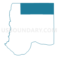
Outline

Summary
| Unique Area Identifier | 667017 |
| Name | VTD-Scotland precinct 1 |
| County | Bon Homme County |
| State | South Dakota |
| Area (square miles) | 106.45 |
| Land Area (square miles) | 106.35 |
| Water Area (square miles) | 0.10 |
| % of Land Area | 99.91 |
| % of Water Area | 0.09 |
| Latitude of the Internal Point | 43.12421770 |
| Longtitude of the Internal Point | -97.81617140 |
Maps


Graphs
Select a template below for downloading or customizing gragh for VTD-Scotland precinct 1, Bon Homme County, South Dakota


Neighbors
Neighoring Voting District (by Name) Neighboring Voting District on the Map
- VTD precinct 1, Hutchinson County, SD
- VTD precinct 6, Hutchinson County, SD
- VTD precinct 7, Hutchinson County, SD
- VTD-Avon precinct 2, Bon Homme County, SD
- VTD-precinct 17 OdessaTwp, Yankton County, SD
- VTD-precinct 18 LestervilleTwp, Yankton County, SD
- VTD-Tabor precinct 4, Bon Homme County, SD
- VTD-Tyndall precinct 3, Bon Homme County, SD
Top 10 Neighboring County Subdivision (by Population) Neighboring County Subdivision on the Map
- West Yankton UT, Yankton County, SD (3,474)
- Scotland city, Bon Homme County, SD (841)
- Northeast Bon Homme UT, Bon Homme County, SD (468)
- Northwest Bon Homme UT, Bon Homme County, SD (403)
- Sweet township, Hutchinson County, SD (285)
- Kaylor township, Hutchinson County, SD (170)
- Capital township, Hutchinson County, SD (80)
- Fair township, Hutchinson County, SD (79)
- Oak Hollow township, Hutchinson County, SD (41)
Top 10 Neighboring Place (by Population) Neighboring Place on the Map
Top 10 Neighboring Unified School District (by Population) Neighboring Unified School District on the Map
- Bon Homme School District 04-2, SD (4,791)
- Scotland School District 04-3, SD (1,870)
- Tripp-Delmont School District 33-5, SD (1,540)
- Menno School District 33-2, SD (1,536)
- Avon School District 04-1, SD (1,158)
Top 10 Neighboring State Legislative District Lower Chamber (by Population) Neighboring State Legislative District Lower Chamber on the Map
Top 10 Neighboring State Legislative District Upper Chamber (by Population) Neighboring State Legislative District Upper Chamber on the Map
Top 10 Neighboring 111th Congressional District (by Population) Neighboring 111th Congressional District on the Map
Top 10 Neighboring Census Tract (by Population) Neighboring Census Tract on the Map
- Census Tract 9664, Yankton County, SD (3,807)
- Census Tract 9677, Bon Homme County, SD (3,616)
- Census Tract 9676, Bon Homme County, SD (3,454)
- Census Tract 9688, Hutchinson County, SD (1,914)